 Welcome to the Pleasant Valley/North Carver Comprehensive Plan web site.
This is an exciting time for the area, as this plan will allow the expansion of quality public services, such as police, schools, and parks, as well as offer community members a voice in the planning process. The plan will build off the efforts of the adjacent (to the west) East Happy Valley Comprehensive Plan, adopted in 2009, and provide direction for the City’s overall Comprehensive Plan. The City has worked with advisory groups and community members since 2018 to develop the Pleasant Valley/North Carver Comprehensive Plan. The Plan shapes the future of approximately 2,700 acres along the east side of Happy Valley with a balance of housing options and livable neighborhoods, well-planned parks and trails, safe and efficient streets, environmental protections, and local employment and business opportunities. Though some development may occur soon after approval, the plan is long term, implemented over decades as property owners choose to develop their land.

Approved Pleasant Valley / North Carver Comprehensive Plan
The City Council approved the Pleasant Valley/North Carver Comprehensive Plan at their March 7, 2023 hearing. We really appreciate the community taking the time to provide input over the years! The adopted Plan is now effective and the updated zoning has been applied to properties within the city limits. We now have a plan in place for when property owners choose to annex into Happy Valley and develop. The plan is long-term and we expect that the plan area will not be fully developed for decades. The notice of decision has been sent out and the adopted documents may be found below.
- Zoning Map for PV/NC + Updated Citywide Zoning Map You may learn more about the zoning designations here.
- Interactive Zoning Map You may learn more about the zoning designations here.
- Summary Report
- Transportation System Plan
- Wetlands Inventory
- Parks and Recreation Master Plan Update
- Text Amendments to the Comprehensive Plan
- Rock Creek Employment Center Subdistrict (LDC 16.25)
- Pleasant Valley Neighborhood Center Overlay Zone (LDC 16.36)
- Carver Riverfront Overlay Zone (LDC 16.37)
- Landscaping, Street Trees, Fences and Walls, Recreation Areas (LDC 16.42)
- Annexation (LDC 16.67)
No, the PV/NC Comp Plan does not require or compel annexation by the local government (from the “top down”). Rather, property owners that are interested in future urban zoning and its greater potential land value may wish to annex via petition (from the “bottom up”). In the roughly 2,700-acre PV/NC Comp Plan area, approximately 1,000 acres of land have already opted to annex to the City of Happy Valley. These lands are represented by the darker colored lands on the overall PV/NC boundary map. All other lands remain in unincorporated Clackamas County.
In 2002, Metro (the regional government) expanded the Portland Urban Growth Boundary (UGB) quite a bit to the east (toward 242nd Ave.). The City of Damascus was incorporated and launched several versions of Comprehensive Plans which it voluntarily put on the ballot for approval from the then city residents (none passed). After the disincorporation of the City of Damascus, property owners representing approximately 1,000 acres of former Damascus voluntarily annexed to the City of Happy Valley. By State and Regional law, the City was then responsible to develop a comprehensive plan. The City applied for a $400,000 grant from Metro to fund the majority of the PV/NC Comp Plan. The planning area for this exercise included land that had recently annexed, as well as land that might annex in the next few years. This planning effort is required for UGB expansion areas by state law and Metro Functional Plan requirements. In the City of Happy Valley process, the PV/NC Comp Plan was developed in partnership with a Technical Advisory Committee (TAC) and Community Advisory Committee (CAC), which made recommendations to the City’s Planning Commission. The Planning Commission then reviews the Draft PV/NC Plan, considers all requests and changes, and then makes a recommendation to the City Council. The City Council is the final review authority as there is no general vote. If a group or individual seeks to appeal the City Council’s decision, they can do so to the Oregon Land Use Board of Appeals (LUBA).
In the very long run, the PV/NC Plan area assumes development of a future Sunrise Phase 2 (Expressway) travelling from 122nd Ave. where Phase 1 currently ends to 172nd Ave. In the shorter term, OR Hwys. 212 and 224 (state highways) are designated as Major Arterials on the City’s TSP. Future developments that might seek land use approval would need to improve applicable frontages on the facility, plus – would need to provide “built-year” Traffic Impact Studies that address the transportation congestion level of said highways/intersections (and what mitigations/improvements the development would trigger in order to be approved). For larger issues like the Rock Creek Intersection, the City of Happy Valley, working in conjunction with the Oregon Dept. of Transportation (ODOT) and Clackamas County Dept. of Transportation & Development (DTD), have several potential funding opportunities to fund “interim improvements” to the Rock Creek Intersection. These include creating a “Zone of Influence” wherein the proportionate share of the cost of the improvement to the intersection improvements cause future developments in a very large geographic area to contribute funds to the intersection improvements. Other potential measures include City funded Capital Improvement Projects, federal dollars being allocated to Oregon/Clackamas County, grant funds, Transportation System Development Charge (TSDC) Overlays and Local Improvement Districts.
If your property is not within the city limits, it retains its unincorporated Clackamas County rural zoning. If your property is within the city limits, the urban zone is applied to your property and it is “upzoned” to the plan designation/zoning district indicated on the map and on the City’s interactive website. If you have a lawfully established (including any necessary land use or building permits from unincorporated Clackamas County) pre-existing, non-conforming use, structure or livestock scenario, this is considered a “grand-fathered” scenario once annexed within the city limits. This means property owners are allowed to maintain and use their current buildings including homes, barns, shops, businesses, etc. However, expanding these structures is often limited.
Besides the economic value of “upzoning” (increase property values), other benefits of annexation include participation in the City’s dedicated police force, code enforcement program, street sweeping and inclement weather service, belonging to the City’s Park and Recreation Program, voting for City of Happy Valley City Council and the City’s commitment to customer service and growth management. The costs of annexation primarily come in the form of increased taxes (the addition of the City’s municipal tax rate; the local Police Levy and the local Parks & Recreation levy). These are offset somewhat by a reduction of taxes when leaving disincorporated Clackamas County. For additional information, please see this link: Annexation Program | City of Happy Valley (happyvalleyor.gov).
HIGHLIGHTS OF THE PLEASANT VALLEY/NORTH CARVER COMPREHENSIVE PLAN
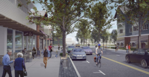
The Pleasant Valley Neighborhood Center

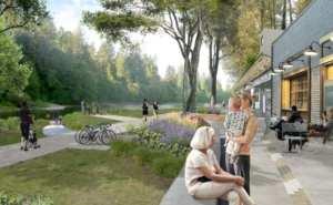
The Carver Riverfront District

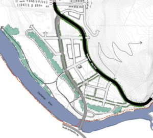
Highway 224 Realignment and Carver Local Street Network

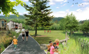
Variety of Housing Options and Parks and Recreation Opportunities

Latest News:
After a series of public hearings before the Planning Commission and the City Council, the Pleasant Valley/North Carver Comprehensive Plan was approved on March 7, 2023! Nearly 200 participants attended the hearing in person with an additional 50 attendees joining the event online. The Plan shapes the future of approximately 2,700 acres along the east side of Happy Valley with a balance of housing options and livable neighborhoods, well-planned parks and trails, safe and efficient streets, environmental protections, and local employment and business opportunities. Led by the Happy Valley Economic and Community Development Department, the Plan took over five years to fine tune and included countless hours of preparation to complete. A wide variety of input received from property owners, prospective developers, existing residents of Happy Valley, and residents from the Damascus area helped shape the final vision.

Community Provides Vision for the Pleasant Valley/North Carver Comprehensive Plan
The PV/NC Comprehensive Plan process is underway. The City formed a Community Advisory Committee (CAC) and the Technical Advisory Committee (TAC) to help develop the plan and assist with community outreach. Seven CAC meetings have occurred since October 2018, with three more planned.
In addition to the CAC, community members will have plenty of opportunities to hear about area land use and transportation plans, and to provide input on how police, schools, parks and public services should be provided. Two community workshops were held in spring 2019, with over 130 participants. Two open house events are also planned for spring/summer 2021 to gain feedback from residents. Your input will help develop the community vision for the Comprehensive Plan.
Contacts
Michael D. Walter, AICP
Economic & Community Development Director
Laura Terway, AICP
Assistant Economic & Community Development Director
Chris Alfino, AICP
Senior Planner
Michael Cynkar, AICP
Senior Planner
Cheryl Whitehead
Planning Assistant